Prekės informacija
Garmin GPSmap 64 Worldwide
Prekės aprašymas anglų kalba:
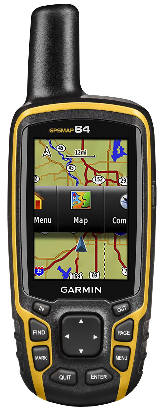
Rugged, Full-featured Handheld with GPS and GLONASS Combined
2.6" sunlight-readable color screen
High-sensitivity GPS and GLONASS receiver with quad helix antenna
4 GB of internal memory and a microSD™ card slot
250,000 preloaded caches for paperless caching from Geocaching.com
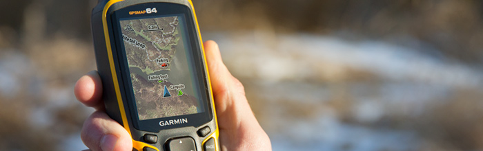
GPSMAP 64 features a 2.6" sunlight-readable color screen that supports BirdsEye Satellite Imagery (subscription required) and Garmin Custom Maps. Rugged and waterproof, GPSMAP 64 uses a quad helix antenna for superior reception.
Explore the Terrain
GPSMAP 64 comes with a built-in worldwide basemap with shaded relief so you can navigate anywhere with ease. With photo navigation, you can download geotagged pictures from the Internet and navigate to them.
Keep Your Fix
With its quad helix antenna and high-sensitivity, GPS and GLONASS, receiver, GPSMAP 64 locates your position quickly and precisely and maintains its location even in heavy cover and deep canyons. The advantage is clear — whether you’re in deep woods or just near tall buildings and trees, you can count on GPSMAP 64 to help you find your way when you need it the most.
Add Maps
Adding more maps to GPSMAP 64 is easy with our array of detailed topographic, marine and road maps. With 4 GB of onboard memory and microSD card slot, you can conveniently download TOPO 24K and 100K maps and hit the trail, plug in BlueChart® g2 preloaded cards for a great day on the water or City Navigator NT® map data for turn-by-turn routing on roads (see maps tab for compatibility). GPSMAP 64 also supports BirdsEye Satellite Imagery (subscription required) that lets you load satellite images onto your device and integrate them with your maps. In addition, the 64 is compatible with Custom Maps, a map format that allows you to transform paper and electronic maps easily into downloadable maps for your device, for free.
Find Fun
GPSMAP 64 supports paperless geocaching with 250,000 preloaded caches with hints and descriptions from Geocaching.com, and has a 16-hour battery life. By going paperless, you're not only helping the environment, but also improving efficiency. GPSMAP 64 stores and displays key information, including location, terrain, difficulty, hints and descriptions, which means there’s no more manually entering coordinates and paper printouts! Slim and lightweight, 64 is the perfect companion for all your outdoor pursuits.
Plan Your Next Trip
Take charge of your next adventure with BaseCamp™, software that lets you view and organize maps, waypoints, routes and tracks. This free trip-planning software even allows you to create Garmin Adventures that you can share with friends, family or fellow explorers. BaseCamp displays topographic map data in 2-D or 3-D on your computer screen, including contour lines and elevation profiles. It also can transfer an unlimited amount of satellite images to your device when paired with a BirdsEye Satellite Imagery subscription.
Prekės aprašymas anglų kalba:
Rugged, Full-featured Handheld with GPS and GLONASS Combined
2.6" sunlight-readable color screen
High-sensitivity GPS and GLONASS receiver with quad helix antenna
4 GB of internal memory and a microSD™ card slot
250,000 preloaded caches for paperless caching from Geocaching.com
GPSMAP 64 features a 2.6" sunlight-readable color screen that supports BirdsEye Satellite Imagery (subscription required) and Garmin Custom Maps. Rugged and waterproof, GPSMAP 64 uses a quad helix antenna for superior reception.
Explore the Terrain
GPSMAP 64 comes with a built-in worldwide basemap with shaded relief so you can navigate anywhere with ease. With photo navigation, you can download geotagged pictures from the Internet and navigate to them.
Keep Your Fix
With its quad helix antenna and high-sensitivity, GPS and GLONASS, receiver, GPSMAP 64 locates your position quickly and precisely and maintains its location even in heavy cover and deep canyons. The advantage is clear — whether you’re in deep woods or just near tall buildings and trees, you can count on GPSMAP 64 to help you find your way when you need it the most.
Add Maps
Adding more maps to GPSMAP 64 is easy with our array of detailed topographic, marine and road maps. With 4 GB of onboard memory and microSD card slot, you can conveniently download TOPO 24K and 100K maps and hit the trail, plug in BlueChart® g2 preloaded cards for a great day on the water or City Navigator NT® map data for turn-by-turn routing on roads (see maps tab for compatibility). GPSMAP 64 also supports BirdsEye Satellite Imagery (subscription required) that lets you load satellite images onto your device and integrate them with your maps. In addition, the 64 is compatible with Custom Maps, a map format that allows you to transform paper and electronic maps easily into downloadable maps for your device, for free.
Find Fun
GPSMAP 64 supports paperless geocaching with 250,000 preloaded caches with hints and descriptions from Geocaching.com, and has a 16-hour battery life. By going paperless, you're not only helping the environment, but also improving efficiency. GPSMAP 64 stores and displays key information, including location, terrain, difficulty, hints and descriptions, which means there’s no more manually entering coordinates and paper printouts! Slim and lightweight, 64 is the perfect companion for all your outdoor pursuits.
Plan Your Next Trip
Take charge of your next adventure with BaseCamp™, software that lets you view and organize maps, waypoints, routes and tracks. This free trip-planning software even allows you to create Garmin Adventures that you can share with friends, family or fellow explorers. BaseCamp displays topographic map data in 2-D or 3-D on your computer screen, including contour lines and elevation profiles. It also can transfer an unlimited amount of satellite images to your device when paired with a BirdsEye Satellite Imagery subscription.
Lankytojai taip pat pirko
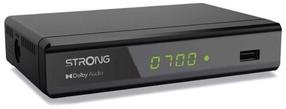
Skaitmeninis imtuvas Strong SRT8119, 14.5 cm x 9.11 cm x 3.55 cm, juoda sp.
55,88 €
Įprasta kaina
69,90 €